
乐天溪 topographic map
Interactive map
Click on the map to display elevation.
About this map
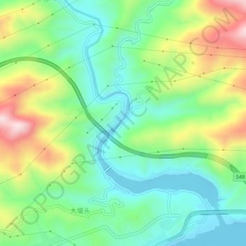
Name: 乐天溪 topographic map, elevation, terrain.
Location: 乐天溪, 夷陵区, 宜昌市, 湖北省, 中国 (30.85615 111.06437 30.89088 111.09154)
Average elevation: 197 m
Minimum elevation: 61 m
Maximum elevation: 458 m
Other topographic maps
Click on a map to view its topography, its elevation and its terrain.