
徐庄镇 topographic map
Interactive map
Click on the map to display elevation.
About this map
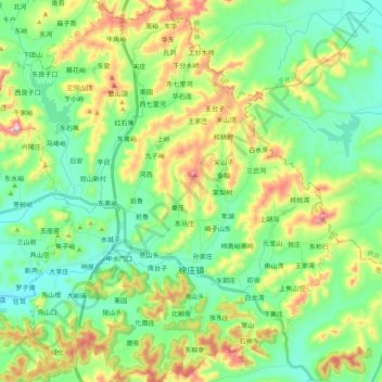
Name: 徐庄镇 topographic map, elevation, terrain.
Location: 徐庄镇, 山亭区, 枣庄市, 山东省, 中国 (35.00925 117.48027 35.17165 117.65634)
Average elevation: 282 m
Minimum elevation: 132 m
Maximum elevation: 617 m
Other topographic maps
Click on a map to view its topography, its elevation and its terrain.