
冯卯镇 topographic map
Interactive map
Click on the map to display elevation.
About this map
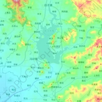
Name: 冯卯镇 topographic map, elevation, terrain.
Location: 冯卯镇, 山亭区, 枣庄市, 山东省, 中国 (35.15879 117.28373 35.26644 117.45272)
Average elevation: 178 m
Minimum elevation: 87 m
Maximum elevation: 533 m
Other topographic maps
Click on a map to view its topography, its elevation and its terrain.