
甘棠镇 topographic map
Interactive map
Click on the map to display elevation.
About this map
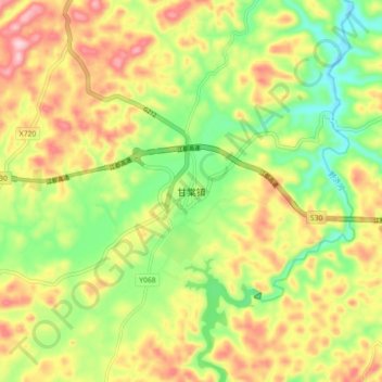
Name: 甘棠镇 topographic map, elevation, terrain.
Location: 甘棠镇, 黔西市, 毕节市, 贵州省, 中国 (27.02259 106.08869 27.10259 106.16869)
Average elevation: 1,203 m
Minimum elevation: 1,091 m
Maximum elevation: 1,332 m
Other topographic maps
Click on a map to view its topography, its elevation and its terrain.