
泥溪镇 topographic map
Interactive map
Click on the map to display elevation.
About this map
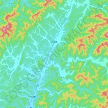
Name: 泥溪镇 topographic map, elevation, terrain.
Location: 泥溪镇, 东至县, 池州市, 安徽省, 247200, 中国 (29.66467 116.79236 29.86791 117.00434)
Average elevation: 143 m
Minimum elevation: 30 m
Maximum elevation: 575 m
Other topographic maps
Click on a map to view its topography, its elevation and its terrain.