
官港镇 topographic map
Interactive map
Click on the map to display elevation.
About this map
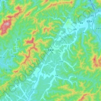
Name: 官港镇 topographic map, elevation, terrain.
Location: 官港镇, 东至县, 池州市, 安徽省, 247200, 中国 (29.81611 116.85361 30.00034 117.07842)
Average elevation: 205 m
Minimum elevation: 29 m
Maximum elevation: 829 m
Other topographic maps
Click on a map to view its topography, its elevation and its terrain.