
菊园新区 topographic map
Interactive map
Click on the map to display elevation.
About this map
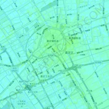
Name: 菊园新区 topographic map, elevation, terrain.
Location: 菊园新区, 嘉定区, 上海市, 中国 (31.33611 121.18619 31.41618 121.26762)
Average elevation: 4 m
Minimum elevation: 2 m
Maximum elevation: 7 m
Other topographic maps
Click on a map to view its topography, its elevation and its terrain.