
西峰区 topographic map
Interactive map
Click on the map to display elevation.
About this map
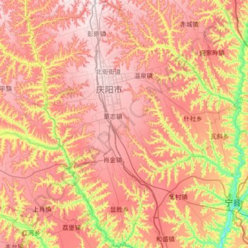
Name: 西峰区 topographic map, elevation, terrain.
Location: 西峰区, 庆阳市, 甘肃省, 745115, 中国 (35.42632 107.46561 35.86690 107.88359)
Average elevation: 1,226 m
Minimum elevation: 924 m
Maximum elevation: 1,450 m
Other topographic maps
Click on a map to view its topography, its elevation and its terrain.