
Argeș topographic map
Interactive map
Click on the map to display elevation.
About this map
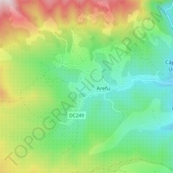
Name: Argeș topographic map, elevation, terrain.
Location: Arefu, Argeș, 117041, Romania (45.31790 24.58705 45.34294 24.64769)
Average elevation: 825 m
Minimum elevation: 614 m
Maximum elevation: 1,229 m
Other topographic maps
Click on a map to view its topography, its elevation and its terrain.
Retezat National Park
Retezat National Park, Hunedoara, Romania
Average elevation: 1,443 m
Danube Delta Biosphere Reserve
Danube Delta Biosphere Reserve, Tulcea, 827051, Romania
Average elevation: 3 m