
万盛街道 topographic map
Interactive map
Click on the map to display elevation.
About this map
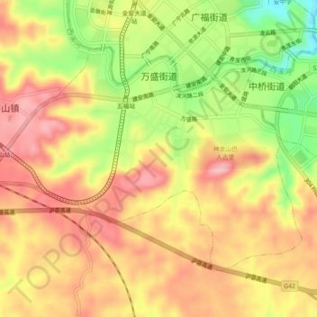
Name: 万盛街道 topographic map, elevation, terrain.
Location: 万盛街道, 广安区, 广安市, 四川省, 中国 (30.43212 106.60230 30.45927 106.64688)
Average elevation: 328 m
Minimum elevation: 235 m
Maximum elevation: 391 m
Other topographic maps
Click on a map to view its topography, its elevation and its terrain.