
Thank you for supporting this site ❤️
Make a donation
Make a donation
Creston topographic map
Click on the map to display elevation.
Thank you for supporting this site ❤️
Make a donation
Make a donation
About this map
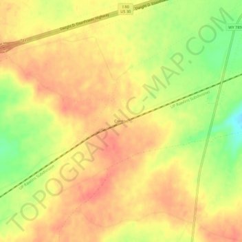
Name: Creston topographic map, elevation, terrain.
Location: Creston, Sweetwater County, Wyoming, United States (41.68385 -107.77674 41.72385 -107.73674)
Average elevation: 2,162 m
Minimum elevation: 2,125 m
Maximum elevation: 2,181 m
Thank you for supporting this site ❤️
Make a donation
Make a donation
Other topographic maps
Click on a map to view its topography, its elevation and its terrain.
Arrowhead Springs
United States > Wyoming > Sweetwater County > Arrowhead Springs
Average elevation: 2,056 m
Thank you for supporting this site ❤️
Make a donation
Make a donation