Geolocate

Table Rock topographic map

Interactive map

Click on the map to display elevation.

About this map

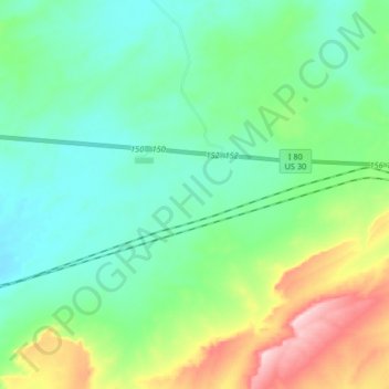
Name: Table Rock topographic map, elevation, terrain.

Location: Table Rock, Sweetwater County, Wyoming, United States (41.60614 -108.42763 41.63574 -108.26355)

Average elevation: 2,110 m

Minimum elevation: 2,050 m

Maximum elevation: 2,283 m

Other topographic maps

Click on a map to view its topography, its elevation and its terrain.

Creston

United States > Wyoming > Sweetwater County

Creston, Sweetwater County, Wyoming, United States

Average elevation: 2,162 m

North Rock Springs

United States > Wyoming > Sweetwater County

North Rock Springs, Sweetwater County, Wyoming, United States

Average elevation: 2,083 m

Arrowhead Springs

United States > Wyoming > Sweetwater County > Arrowhead Springs

Arrowhead Springs, Sweetwater County, Wyoming, United States

Average elevation: 2,056 m

Rock Springs

United States > Wyoming > Sweetwater County

Rock Springs, Sweetwater County, Wyoming, 82901, United States

Average elevation: 2,024 m

Rock Springs

United States > Wyoming > Sweetwater County > Rock Springs

Rock Springs, Sweetwater County, Wyoming, 82901, United States

Average elevation: 2,057 m

Point of Rocks

United States > Wyoming > Sweetwater County

Point of Rocks, Sweetwater County, Wyoming, United States

Average elevation: 2,060 m

White Mountain

United States > Wyoming > Sweetwater County

White Mountain, Sweetwater County, Wyoming, United States

Average elevation: 2,170 m

Green River

United States > Wyoming > Sweetwater County

Green River, Sweetwater County, Wyoming, 82935, United States

Average elevation: 1,985 m