
Junction City topographic map
Interactive map
Click on the map to display elevation.
About this map
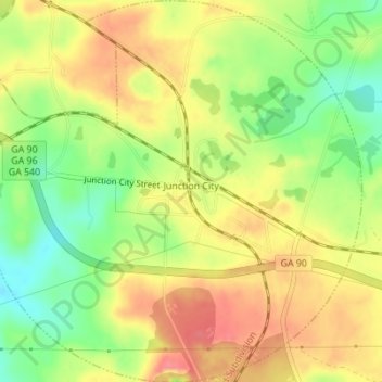
Name: Junction City topographic map, elevation, terrain.
Location: Junction City, Talbot County, Georgia, United States (32.58847 -84.47816 32.61748 -84.44394)
Average elevation: 203 m
Minimum elevation: 165 m
Maximum elevation: 234 m
Other topographic maps
Click on a map to view its topography, its elevation and its terrain.
Flint River
United States > Georgia > Talbot County
Flint River, Talbot County, Georgia, United States
Average elevation: 225 m
Talbotton
United States > Georgia > Talbot County
Talbotton, Talbot County, Georgia, United States
Average elevation: 203 m