
Thank you for supporting this site ❤️
Make a donation
Make a donation
Talbotton topographic map
Click on the map to display elevation.
Thank you for supporting this site ❤️
Make a donation
Make a donation
About this map
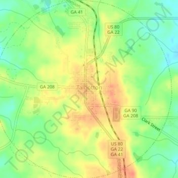
Name: Talbotton topographic map, elevation, terrain.
Location: Talbotton, Talbot County, Georgia, United States (32.66279 -84.55771 32.69176 -84.52341)
Average elevation: 203 m
Minimum elevation: 179 m
Maximum elevation: 224 m
Thank you for supporting this site ❤️
Make a donation
Make a donation
Other topographic maps
Click on a map to view its topography, its elevation and its terrain.