
金崖镇 topographic map
Interactive map
Click on the map to display elevation.
About this map
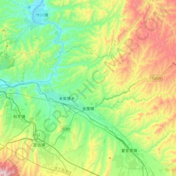
Name: 金崖镇 topographic map, elevation, terrain.
Location: 金崖镇, 榆中县, 兰州市, 甘肃省, 中国 (35.91585 104.03106 36.18239 104.31008)
Average elevation: 1,837 m
Minimum elevation: 1,478 m
Maximum elevation: 2,600 m
Other topographic maps
Click on a map to view its topography, its elevation and its terrain.