
夏官营镇 topographic map
Interactive map
Click on the map to display elevation.
About this map
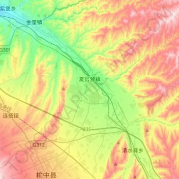
Name: 夏官营镇 topographic map, elevation, terrain.
Location: 夏官营镇, 榆中县, 兰州市, 甘肃省, 中国 (35.84246 104.09236 36.04278 104.29485)
Average elevation: 1,881 m
Minimum elevation: 1,560 m
Maximum elevation: 2,287 m
Other topographic maps
Click on a map to view its topography, its elevation and its terrain.