
厚坝镇 topographic map
Interactive map
Click on the map to display elevation.
About this map
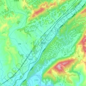
Name: 厚坝镇 topographic map, elevation, terrain.
Location: 厚坝镇, 江油市, 绵阳市, 四川省, 621715, 中国 (31.93116 105.01079 32.00500 105.12723)
Average elevation: 655 m
Minimum elevation: 542 m
Maximum elevation: 964 m
Other topographic maps
Click on a map to view its topography, its elevation and its terrain.