
Dunhuang City topographic map
Interactive map
Click on the map to display elevation.
About this map
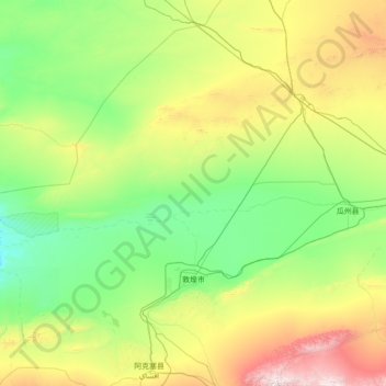
Name: Dunhuang City topographic map, elevation, terrain.
Location: Dunhuang City, Jiuquan, Gansu, 736200, China (39.64238 92.70186 41.57057 95.50180)
Average elevation: 1,536 m
Minimum elevation: 896 m
Maximum elevation: 4,465 m
Other topographic maps
Click on a map to view its topography, its elevation and its terrain.