
汝阳县 topographic map
Interactive map
Click on the map to display elevation.
About this map
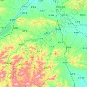
Name: 汝阳县 topographic map, elevation, terrain.
Location: 汝阳县, 洛阳市, 河南省, 中国 (33.80641 112.19743 34.36019 112.61653)
Average elevation: 518 m
Minimum elevation: 183 m
Maximum elevation: 1,564 m
Other topographic maps
Click on a map to view its topography, its elevation and its terrain.