
建安门街道 topographic map
Interactive map
Click on the map to display elevation.
About this map
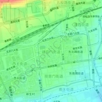
Name: 建安门街道 topographic map, elevation, terrain.
Location: 建安门街道, 老城区, 洛阳市, 河南省, 中国 (34.68362 112.46412 34.69277 112.48055)
Average elevation: 148 m
Minimum elevation: 129 m
Maximum elevation: 186 m
Other topographic maps
Click on a map to view its topography, its elevation and its terrain.