Geolocate

黄埠 topographic map

Interactive map

Click on the map to display elevation.

About this map

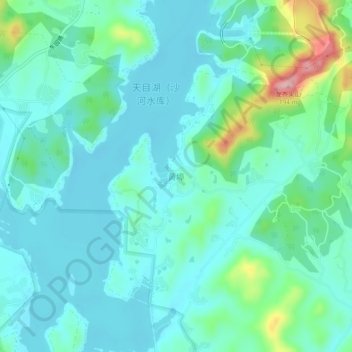
Name: 黄埠 topographic map, elevation, terrain.

Location: 黄埠, 常州市, 江苏省, 213000, 中国 (31.25057 119.39821 31.29057 119.43821)

Average elevation: 47 m

Minimum elevation: 13 m

Maximum elevation: 184 m

Other topographic maps

Click on a map to view its topography, its elevation and its terrain.

茅山山脉

中国 > 江苏省 > 常州市

茅山山脉, 常州市, 江苏省, 213000, 中国

Average elevation: 36 m

三河村

中国 > 江苏省 > 常州市

三河村, 常州市, 江苏省, 213000, 中国

Average elevation: 5 m

滆湖

中国 > 江苏省 > 常州市

滆湖, 常州市, 江苏省, 213000, 中国

Average elevation: 4 m

祁家村

中国 > 江苏省 > 常州市

祁家村, 常州市, 江苏省, 213000, 中国

Average elevation: 8 m

太阳山

中国 > 江苏省 > 常州市

太阳山, 常州市, 江苏省, 213000, 中国

Average elevation: 119 m

中梅

中国 > 江苏省 > 常州市

中梅, 常州市, 江苏省, 213000, 中国

Average elevation: 9 m

前峰山

中国 > 江苏省 > 常州市

前峰山, 常州市, 江苏省, 213000, 中国

Average elevation: 62 m