
鲁山县 topographic map
Interactive map
Click on the map to display elevation.
About this map
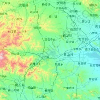
Name: 鲁山县 topographic map, elevation, terrain.
Location: 鲁山县, 平顶山市, 河南省, 中国 (33.56051 112.24168 33.99118 113.23261)
Average elevation: 367 m
Minimum elevation: 92 m
Maximum elevation: 2,108 m
Other topographic maps
Click on a map to view its topography, its elevation and its terrain.