
大安镇 topographic map
Interactive map
Click on the map to display elevation.
About this map
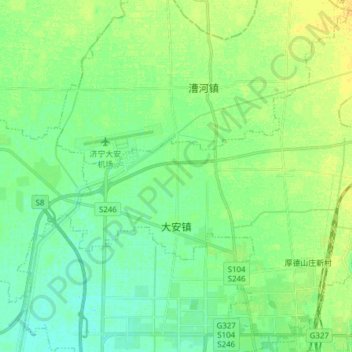
Name: 大安镇 topographic map, elevation, terrain.
Location: 大安镇, 兖州区, 济宁市, 山东省, 中国 (35.57480 116.72056 35.69268 116.87418)
Average elevation: 52 m
Minimum elevation: 43 m
Maximum elevation: 64 m
Other topographic maps
Click on a map to view its topography, its elevation and its terrain.