
房村镇 topographic map
Interactive map
Click on the map to display elevation.
About this map
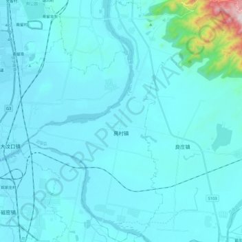
Name: 房村镇 topographic map, elevation, terrain.
Location: 房村镇, 岱岳区, 泰安市, 山东省, 271000, 中国 (35.88348 117.10898 36.05536 117.26053)
Average elevation: 148 m
Minimum elevation: 90 m
Maximum elevation: 975 m
Other topographic maps
Click on a map to view its topography, its elevation and its terrain.