
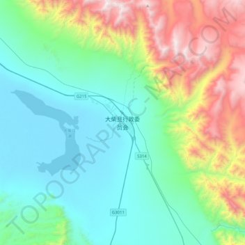
大柴旦行政委员会 topographic map
Interactive map
Click on the map to display elevation.
About this map
Name: 大柴旦行政委员会 topographic map, elevation, terrain.
Location: 大柴旦行政委员会, 柴旦镇, 大柴旦行政委员会, 海西蒙古族藏族自治州, 青海省, 816200, 中国 (37.69496 95.19398 38.01496 95.51398)
Average elevation: 3,716 m
Minimum elevation: 3,147 m
Maximum elevation: 5,384 m
大柴旦地区海拔较高,行政委员会驻地柴旦镇海拔3173米,气候终年多风少雨,年平均降水量为83.5毫米,无霜期为108天,年平均气温1.4摄氏度,属高原沙漠气候。大柴旦地区的河流均为内流河,湖泊多为盐湖,水源以周边山地冰雪融水和地下水为主要补给来源。区内多雅丹地貌、温泉。
Other topographic maps
Click on a map to view its topography, its elevation and its terrain.