
都昌街道 topographic map
Interactive map
Click on the map to display elevation.
About this map
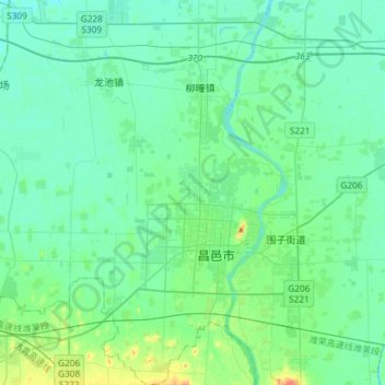
Name: 都昌街道 topographic map, elevation, terrain.
Location: 都昌街道, 昌邑市, 潍坊市, 山东省, 中国 (36.75902 119.21119 36.99441 119.41484)
Average elevation: 9 m
Minimum elevation: 0 m
Maximum elevation: 46 m
Other topographic maps
Click on a map to view its topography, its elevation and its terrain.
昌邑市城市规划技术服务中心潍河西开放式养殖项目
昌邑市城市规划技术服务中心潍河西开放式养殖项目, 昌邑市, 潍坊市, 山东省, 中国
Average elevation: 0 m