
Widdersdorf topographic map
Interactive map
Click on the map to display elevation.
About this map
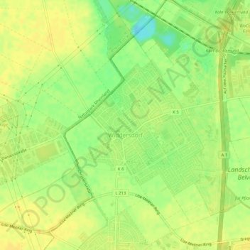
Name: Widdersdorf topographic map, elevation, terrain.
Location: Widdersdorf, Lindenthal, Köln, Nordrhein-Westfalen, Deutschland (50.95419 6.81860 50.97830 6.86923)
Average elevation: 57 m
Minimum elevation: 41 m
Maximum elevation: 65 m
Other topographic maps
Click on a map to view its topography, its elevation and its terrain.
Volkhoven/Weiler
Deutschland > Nordrhein-Westfalen > Köln > Auweiler
Volkhoven/Weiler, Chorweiler, Auweiler, Köln, Regierungsbezirk Köln, Nordrhein-Westfalen, 50765, Deutschland
Average elevation: 47 m