
Volkhoven/Weiler topographic map
Interactive map
Click on the map to display elevation.
About this map
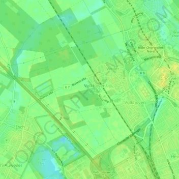
Name: Volkhoven/Weiler topographic map, elevation, terrain.
Average elevation: 47 m
Minimum elevation: 36 m
Maximum elevation: 55 m
Other topographic maps
Click on a map to view its topography, its elevation and its terrain.
Widdersdorf
Deutschland > Nordrhein-Westfalen > Köln > Auweiler
Widdersdorf, Lindenthal, Köln, Nordrhein-Westfalen, Deutschland
Average elevation: 57 m