
坦洲镇 topographic map
Interactive map
Click on the map to display elevation.
About this map
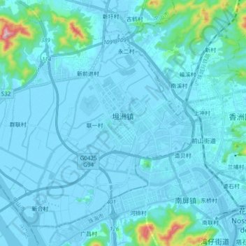
Name: 坦洲镇 topographic map, elevation, terrain.
Location: 坦洲镇, 中山市, 广东省, 中国 (22.20574 113.35785 22.32495 113.50907)
Average elevation: 31 m
Minimum elevation: -4 m
Maximum elevation: 446 m
Other topographic maps
Click on a map to view its topography, its elevation and its terrain.