
沙溪镇 topographic map
Interactive map
Click on the map to display elevation.
About this map
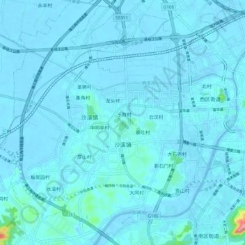
Name: 沙溪镇 topographic map, elevation, terrain.
Location: 沙溪镇, 中山市, 广东省, 中国 (22.47479 113.26469 22.56347 113.34976)
Average elevation: 8 m
Minimum elevation: -9 m
Maximum elevation: 177 m
Other topographic maps
Click on a map to view its topography, its elevation and its terrain.