Geolocate

湖塘镇 topographic map

Interactive map

Click on the map to display elevation.

About this map

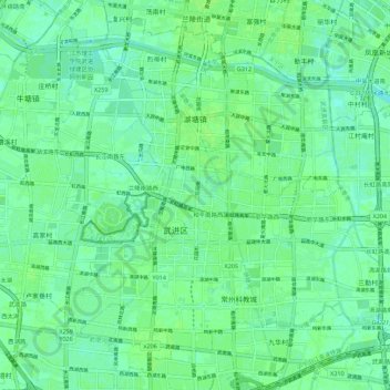
Name: 湖塘镇 topographic map, elevation, terrain.

Location: 湖塘镇, 武进区, 常州市, 江苏省, 213100, 中国 (31.66728 119.90364 31.75347 120.01500)

Average elevation: 6 m

Minimum elevation: 1 m

Maximum elevation: 9 m

Other topographic maps

Click on a map to view its topography, its elevation and its terrain.

龙江河

中国 > 江苏省 > 武进区 > 嘉泽镇

龙江河, 嘉泽镇, 武进区, 常州市, 江苏省, 213100, 中国

Average elevation: 7 m

小焦山岛

中国 > 江苏省 > 武进区 > 雪堰镇

小焦山岛, 雪堰镇, 武进区, 常州市, 江苏省, 213100, 中国

Average elevation: 0 m

常州经济开发区

中国 > 江苏省 > 武进区

常州经济开发区, 武进区, 常州市, 江苏省, 213100, 中国

Average elevation: 5 m

洛阳镇

中国 > 江苏省 > 武进区

洛阳镇, 武进区, 常州市, 江苏省, 213100, 中国

Average elevation: 6 m

大通河

中国 > 江苏省 > 武进区

大通河, 湖塘镇, 武进区, 常州市, 江苏省, 213100, 中国

Average elevation: 6 m

牛塘镇

中国 > 江苏省 > 武进区 > 牛塘镇

牛塘镇, 武进区, 常州市, 江苏省, 213100, 中国

Average elevation: 5 m