
Cabo Carvoeiro topographic map
Interactive map
Click on the map to display elevation.
About this map
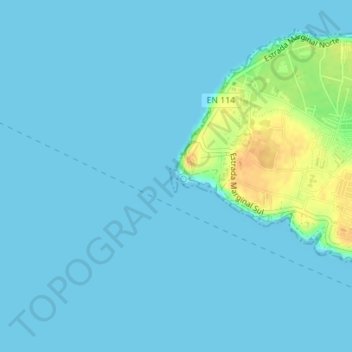
Name: Cabo Carvoeiro topographic map, elevation, terrain.
Location: Cabo Carvoeiro, Peniche, Leiria, 2520-215, Portugal (39.35924 -9.40889 39.35934 -9.40879)
Average elevation: 4 m
Minimum elevation: 0 m
Maximum elevation: 31 m
Other topographic maps
Click on a map to view its topography, its elevation and its terrain.