
Peniche topographic map
Interactive map
Click on the map to display elevation.
About this map
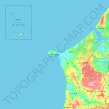
Name: Peniche topographic map, elevation, terrain.
Location: Peniche, Leiria, 2520-265, Portugal (39.19662 -9.54129 39.51662 -9.22129)
Average elevation: 20 m
Minimum elevation: -4 m
Maximum elevation: 200 m
Other topographic maps
Click on a map to view its topography, its elevation and its terrain.
Atouguia da Baleia
Atouguia da Baleia, Peniche, Leiria, Portugal
Average elevation: 42 m
Cabo Carvoeiro
Cabo Carvoeiro, Peniche, Leiria, 2520-215, Portugal
Average elevation: 4 m