Geolocate

涿州经济开发区 topographic map

Interactive map

Click on the map to display elevation.

About this map

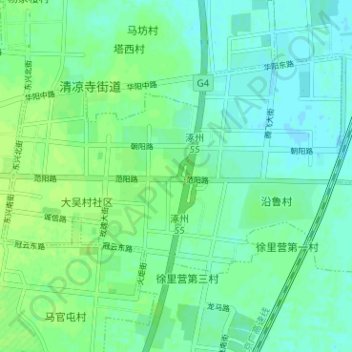
Name: 涿州经济开发区 topographic map, elevation, terrain.

Location: 涿州经济开发区, 涿州市, 保定市, 河北省, 中国 (39.46727 116.00275 39.50046 116.06597)

Average elevation: 32 m

Minimum elevation: 27 m

Maximum elevation: 38 m

Other topographic maps

Click on a map to view its topography, its elevation and its terrain.

文化广场

中国 > 河北省 > 涿州市 > 清凉寺街道

文化广场, 槐林社区, 清凉寺街道, 涿州市, 保定市, 河北省, 中国

Average elevation: 36 m

德信文化公园

中国 > 河北省 > 涿州市 > 清凉寺街道

德信文化公园, 荣兴缘社区, 清凉寺街道, 涿州市, 保定市, 河北省, 中国

Average elevation: 34 m

桃园街道

中国 > 河北省 > 涿州市

桃园街道, 涿州市, 保定市, 河北省, 072750, 中国

Average elevation: 36 m

双塔街道

中国 > 河北省 > 涿州市

双塔街道, 涿州市, 保定市, 河北省, 中国

Average elevation: 34 m

清凉寺街道

中国 > 河北省 > 涿州市

清凉寺街道, 涿州市, 保定市, 河北省, 中国

Average elevation: 33 m