
双井镇 topographic map
Interactive map
Click on the map to display elevation.
About this map
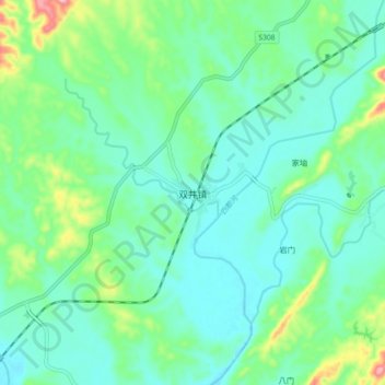
Name: 双井镇 topographic map, elevation, terrain.
Location: 双井镇, 溆浦县, 怀化市, 湖南省, 中国 (27.98426 110.63885 28.06426 110.71885)
Average elevation: 209 m
Minimum elevation: 168 m
Maximum elevation: 349 m
Other topographic maps
Click on a map to view its topography, its elevation and its terrain.