
Thank you for supporting this site ❤️
Make a donation
Make a donation
Mae Lao topographic map
Click on the map to display elevation.
Thank you for supporting this site ❤️
Make a donation
Make a donation
About this map
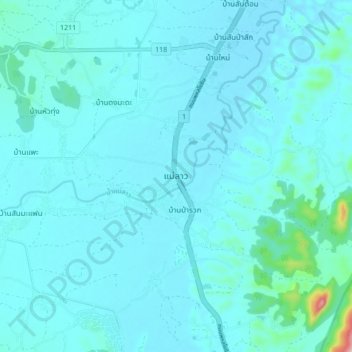
Name: Mae Lao topographic map, elevation, terrain.
Location: Mae Lao, Dong Mada, Chiang Rai Province, Thailand (19.67737 99.67635 19.75737 99.75635)
Average elevation: 436 m
Minimum elevation: 415 m
Maximum elevation: 681 m
Thank you for supporting this site ❤️
Make a donation
Make a donation
Other topographic maps
Click on a map to view its topography, its elevation and its terrain.