
Hastings topographic map
Interactive map
Click on the map to display elevation.
About this map
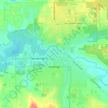
Name: Hastings topographic map, elevation, terrain.
Location: Hastings, Barry County, Michigan, 49058, United States (42.63167 -85.31422 42.66878 -85.26562)
Average elevation: 252 m
Minimum elevation: 229 m
Maximum elevation: 291 m
Other topographic maps
Click on a map to view its topography, its elevation and its terrain.
Hastings Township
United States > Michigan > Barry County
Hastings Township, Barry County, Michigan, United States
Average elevation: 265 m
Thornapple River
United States > Michigan > Barry County > Irving
Thornapple River, Irving, Irving Township, Barry County, Michigan, United States
Average elevation: 236 m
Gun Lake
United States > Michigan > Barry County
Gun Lake, Yankee Springs Township, Barry County, Michigan, United States
Average elevation: 234 m