
Rye Patch Dam topographic map
Interactive map
Click on the map to display elevation.
About this map
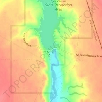
Name: Rye Patch Dam topographic map, elevation, terrain.
Location: Rye Patch Dam, Pershing County, Nevada, United States (40.46807 -118.31069 40.46997 -118.30749)
Average elevation: 1,284 m
Minimum elevation: 1,242 m
Maximum elevation: 1,306 m
Other topographic maps
Click on a map to view its topography, its elevation and its terrain.
Black Rock City
United States > Nevada > Pershing County
Black Rock City, Pershing County, Nevada, United States
Average elevation: 1,191 m
Lovelock
United States > Nevada > Pershing County > Lovelock
Lovelock, Pershing County, Nevada, 89417, United States
Average elevation: 1,214 m
Lovelock
United States > Nevada > Pershing County
Lovelock, Pershing County, Nevada, United States
Average elevation: 1,213 m