
Tai Tam topographic map
Interactive map
Click on the map to display elevation.
About this map
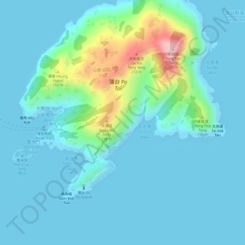
Name: Tai Tam topographic map, elevation, terrain.
Location: Tai Tam, Shan Liu, Islands District, Hong Kong, PRC (22.15392 114.25226 22.17392 114.27226)
Average elevation: 36 m
Minimum elevation: 0 m
Maximum elevation: 226 m
Other topographic maps
Click on a map to view its topography, its elevation and its terrain.