
Thank you for supporting this site ❤️
Make a donation
Make a donation
Woodstock topographic map
Click on the map to display elevation.
Thank you for supporting this site ❤️
Make a donation
Make a donation
About this map
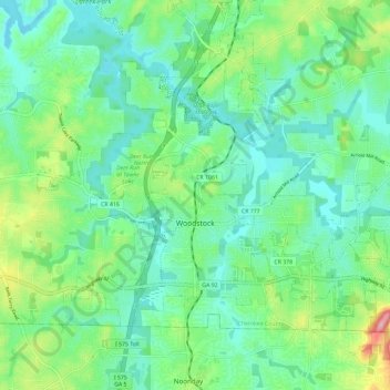
Name: Woodstock topographic map, elevation, terrain.
Location: Woodstock, Cherokee County, Georgia, United States (34.07411 -84.56680 34.14239 -84.44965)
Average elevation: 296 m
Minimum elevation: 251 m
Maximum elevation: 423 m
Thank you for supporting this site ❤️
Make a donation
Make a donation
Other topographic maps
Click on a map to view its topography, its elevation and its terrain.
Thank you for supporting this site ❤️
Make a donation
Make a donation
Thank you for supporting this site ❤️
Make a donation
Make a donation