
Stone County topographic map
Interactive map
Click on the map to display elevation.
About this map
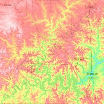
Name: Stone County topographic map, elevation, terrain.
Location: Stone County, Missouri, United States (36.49841 -93.61192 36.99577 -93.30663)
Average elevation: 354 m
Minimum elevation: 212 m
Maximum elevation: 483 m
Other topographic maps
Click on a map to view its topography, its elevation and its terrain.