
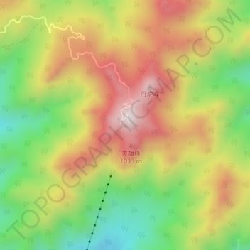
崂顶 topographic map
Interactive map
Click on the map to display elevation.
About this map
Name: 崂顶 topographic map, elevation, terrain.
Location: 崂顶, 崂山区, 青岛市, 山东省, 266100, 中国 (36.17451 120.62551 36.17461 120.62561)
Average elevation: 793 m
Minimum elevation: 489 m
Maximum elevation: 1,099 m
Other topographic maps
Click on a map to view its topography, its elevation and its terrain.