
北麓河 topographic map
Interactive map
Click on the map to display elevation.
About this map
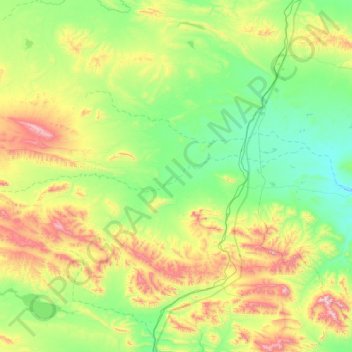
Name: 北麓河 topographic map, elevation, terrain.
Location: 北麓河, 治多县, 玉树藏族自治州, 青海省, 中国 (34.79737 92.36258 34.90621 93.19275)
Average elevation: 4,763 m
Minimum elevation: 4,488 m
Maximum elevation: 5,454 m
Other topographic maps
Click on a map to view its topography, its elevation and its terrain.