
Long An Province topographic map
Interactive map
Click on the map to display elevation.
About this map
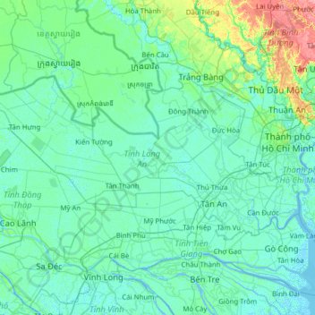
Name: Long An Province topographic map, elevation, terrain.
Location: Long An Province, Vietnam (10.39483 105.50372 11.03214 106.74724)
Average elevation: 7 m
Minimum elevation: -3 m
Maximum elevation: 65 m
Other topographic maps
Click on a map to view its topography, its elevation and its terrain.