
大坪侗族土家族苗族乡 topographic map
Interactive map
Click on the map to display elevation.
About this map
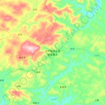
Name: 大坪侗族土家族苗族乡 topographic map, elevation, terrain.
Location: 大坪侗族土家族苗族乡, 万山区, 铜仁市, 贵州省, 558000, 中国 (27.51721 108.91611 27.59721 108.99611)
Average elevation: 651 m
Minimum elevation: 449 m
Maximum elevation: 943 m
Other topographic maps
Click on a map to view its topography, its elevation and its terrain.