
徐家楼街道 topographic map
Interactive map
Click on the map to display elevation.
About this map
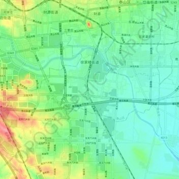
Name: 徐家楼街道 topographic map, elevation, terrain.
Location: 徐家楼街道, 泰山区, 泰安市, 山东省, 271000, 中国 (36.13386 117.05798 36.16727 117.16524)
Average elevation: 141 m
Minimum elevation: 117 m
Maximum elevation: 198 m
Other topographic maps
Click on a map to view its topography, its elevation and its terrain.