
Bouny topographic map
Interactive map
Click on the map to display elevation.
About this map
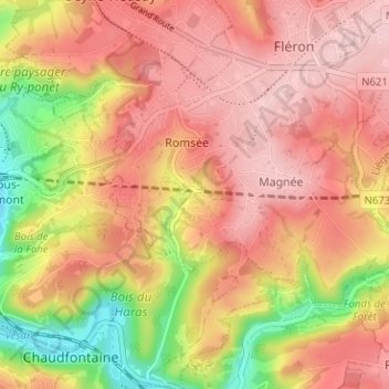
Name: Bouny topographic map, elevation, terrain.
Location: Bouny, Fléron, Liège, Wallonie, 4620, Belgique (50.58156 5.64706 50.62156 5.68706)
Average elevation: 197 m
Minimum elevation: 73 m
Maximum elevation: 270 m
Other topographic maps
Click on a map to view its topography, its elevation and its terrain.