
当雄县 topographic map
Interactive map
Click on the map to display elevation.
About this map
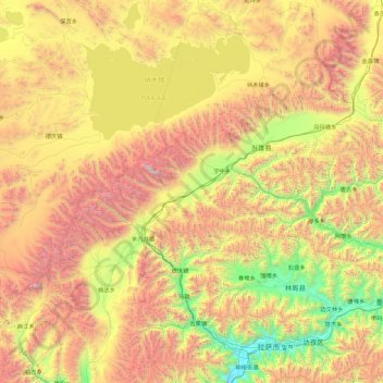
Name: 当雄县 topographic map, elevation, terrain.
Location: 当雄县, 拉萨市, 西藏自治区, 中国 (29.51511 90.07467 31.05753 91.89986)
Average elevation: 4,874 m
Minimum elevation: 3,610 m
Maximum elevation: 7,066 m
Other topographic maps
Click on a map to view its topography, its elevation and its terrain.