
列麦乡 topographic map
Interactive map
Click on the map to display elevation.
About this map
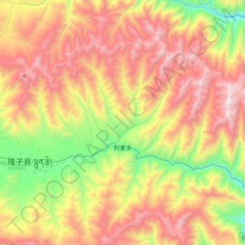
Name: 列麦乡 topographic map, elevation, terrain.
Location: 列麦乡, 隆子县, 山南市, 西藏自治区, 中国 (28.34120 92.51616 28.56256 92.81456)
Average elevation: 4,578 m
Minimum elevation: 3,517 m
Maximum elevation: 5,739 m
Other topographic maps
Click on a map to view its topography, its elevation and its terrain.