
Sidomulyo topographic map
Interactive map
Click on the map to display elevation.
About this map
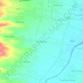
Name: Sidomulyo topographic map, elevation, terrain.
Location: Sidomulyo, Kediri, East Java, 64126, Indonesia (-7.86949 111.95965 -7.82949 111.99965)
Average elevation: 88 m
Minimum elevation: 65 m
Maximum elevation: 164 m
Other topographic maps
Click on a map to view its topography, its elevation and its terrain.
Gunung Butak
Indonesia > East Java > Kediri
Gunung Butak, Kediri, East Java, Jawa, 64151, Indonesia
Average elevation: 203 m